Unlock the full potential of Earth Observation🛰️
GEOspatial Artificial Intelligence (GEOAI) is a research group at the Lebanese National Center for Remote Sensing - CNRS. Our research is focused on geomatics and AI-assisted mapping spanning various applications, including urban analytics, transportation, waterbodies monitoring and crop-yield estimation. We develop tools to automate the process of urban features extraction and crowd-source data collection. Evidence gained from our models allows for a robust humanitarian response and provides policymakers/key-stakeholders with insights to design tailored regulations and safety countermeasures for urban social good.
GEOAI group provides a unique opportunity for geospatial training in a professional research environment in Lebanon. We have hosted more than 60 students at both undergraduate and graduate levels since 2016.
Research Themes
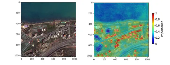
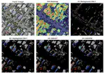
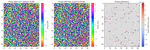
XAI for Earth Observation
Explainable Artificial Intelligence models for Aerial Images
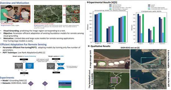
VLM4EO
Vision Language Models for Earth Observation (VLM4EO)
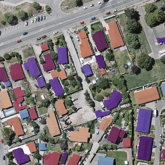
GeoUrban-AI Mapping
Urban Monitoring through Earth Observation
Crop Monitoring using Earth Observation
Lebanese winter wheat monitoring using Aerial Images
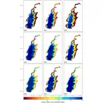
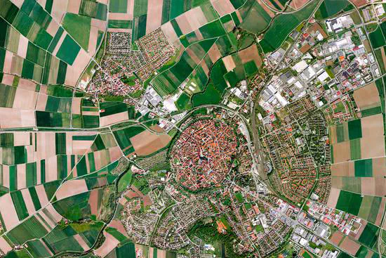
Qaraaoun Reservoir Observatory
Qaraaoun Reservoir Volume Estimation from Aerial Images
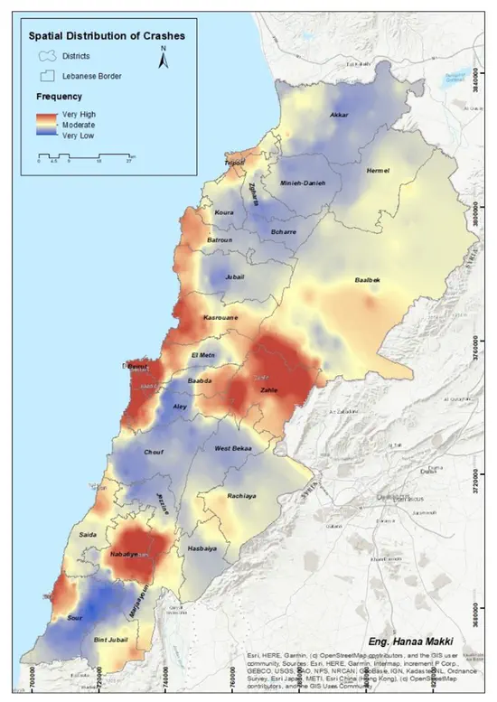
Lebanese Observatory for Crashes on Road
LOCR serves to mine and analyze spatio-temporal road crashes trends using representative time-series.