This website uses cookies to ensure you get the best experience on our website.
Learn more
Got it!
GEOAI group
GEOAI group
Home
Research
Publications
Team
Interns
Media
Contact Us
Projects
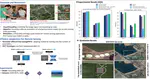
XAI for Earth Observation
Explainable Artificial Intelligence models for Aerial Images
VLM4EO
Vision Language Models for Earth Observation (VLM4EO)
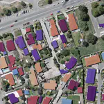
GeoUrban-AI Mapping
Urban Monitoring through Earth Observation
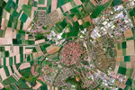
Crop Monitoring using Earth Observation
Lebanese winter wheat monitoring using Aerial Images
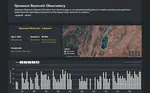
Qaraaoun Reservoir Observatory
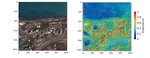
Qaraaoun Reservoir Volume Estimation from Aerial Images
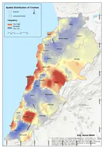
Lebanese Observatory for Crashes on Road
LOCR serves to mine and analyze spatio-temporal road crashes trends using representative time-series.
Cite
×